(The author would like to express his gratitude to the SCIP project directors and the Eforeia of Antiquities in the Cyclades for their kind permission to publish this text).
Walking

A team of archaeologists about to start on a unit of field survey on a small Cycladic Island. What does that mean? Read on: I explain the process below!
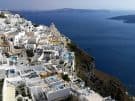
It's eight in the morning and I have been walking for half an hour or so. Glancing to my left, I look down a fairly steep slope, densely overgrown with ankle-high plants, declining towards a rocky shore dipping into the blue waters of the Mediterranean Sea. The summer sun is already high up in the sky, bathing everything I see in its light - a light that gets everywhere, as there is no tree or other source of shade to be seen. The heat will soon follow. I am, along with a few others, on a tiny uninhabited island, a place of rocks and shrubs, in the Cyclades, the archipelago in the Central Aegean that most of us think of when the term 'Greek Islands' is used. Other islands of varying sizes are visible in the distance. An hour earlier, I was on a small boat taking us here.

A clump of wild oregano, one of many thousands scenting the landscape, on a small islet off Antiparos.
As I am walking along this slope, another walker, let's call her N, is more or less exactly 10 metres (33ft) to my left, and another again, M, at the same distance beyond her, followed by two more, B and Nk. We are walking in parallel, forming a row. None of us is really taking in the scenery and the scent of wild oregano and thyme: we're all looking at the ground we walk, our heads sweeping left to right and right to left as we stubbornly traverse whatever terrain there is, in a straight line, stomping through low shrubs, skirting bushes, sometimes climbing through ravines or scaling low cliffs, intermittently stopping to check our compasses or smartphones to make sure we are still walking straight north or south.
Our walking is a fairly slow and mostly quiet process. Acoustically, it is constantly accompanied by the sounds of our steps and of the vegetation brushing against our legs, at times also by the rushing of a soft wind - we hardly notice these sounds. It is also interspersed with a metallic clicking noise now and then, sometimes only a few clicks a minute, sometimes dozens per step, as we walk. Rarely, one of us calls out to H or R, two more walkers darting about a little ahead of us and exempt from the rigidity of the straight line, usually just mouthing a single word: 'feature!'.

The daily trip to work, on a small boat, one of several, in this case accompanied by Poseidonas, the boat dog.
Occasionally, one of us bends down and picks up an object, placing it in a plastic bag before continuing to walk. Much more rarely, one of us may stop briefly, having startled a rabbit or lizard, or having alarmed a ground-nesting seabird. Every hundred metres (328ft) we all stop walking and start shouting out numbers, handing our bags to each other and scribbling numbers on little plastic tags. Afterwards, we resume the same process of walking and looking at the ground for the next 100m. We will continue doing this until mid-afternoon, when the boat will return to take us off the islet.
That was my usual morning for three weeks in late June and much of July. It was hard work, giving me a few bruises and blisters, a lot of scratches and a bit of sunburn, too - but it was full of joys. The joy of being somewhere beautiful, the joy of being in places that few people get to see, the joy of working with great colleagues, the sheer joy of exercise, and the supreme joy of discovery. Let me explain.
An unusual year and an unusual project
What I describe above was my normal morning for those weeks. Normal? - eh, it's a relative term. In a more usual year, I would have been leading tours in Ireland and Greece during that time, but 2020 is different. Most significantly from my point of view, the Peter Sommer Travels programme we all miss running is suspended due to the Covid-19 situation.

This is the same survey team about to start on another unit, in a somewhat more dramatic setting.
For many of my friends and colleagues in academic archaeology, their research programmes for the year are similarly cancelled. That also applied to the Small Cycladic Islands Project (SCIP), an archaeological survey running since 2019 under the auspices of the Eforeia of Antiquities in the Cyclades (part of the Greek Archaeological Service and thus the Greek Ministry of Culture), the Norwegian Institute at Athens and Carleton College (Minnesota). The project is directed by Dr Demetrios Athanasoulis (Director of the Cycladic Eforeia) and co-directed by Professor Alex Knodell (Carleton College) and Dr Zarko Tankosic (Norwegian Institute/University of Bergen).
After the planned 'normal' second season of the project, with its team of international students, had to be cancelled due to the constrictions on travel, Alex and Zarko realised that it might still be possible to conduct useful work, as long as they could rely on archaeologists based in Greece, specifically because Greece had been successful in preventing the virus from spreading widely. That's what happened and I'm glad to have been one of those archaeologists.

Part of our international team, exploring a rocky beach on a small island.
So, at extraordinarily short notice, I found myself part of a small team of experienced field archaeologists conducting a survey. Only about fifteen in number, the team was an example of how Greek archaeology is an international and collaborative field these days: it included experts in different fields and of multiple nationalities: Norwegian, US American, Greek, Serbian, Turkish, Bulgarian, Canadian, British, Australian, Israeli, Puerto Rican and German.
Not all archaeologists dig - archaeological survey
I often mention the practice of archaeological survey on Peter Sommer Travels' tours, not just because it is part of my scholarly background, having been involved in surveys since the 1990s, but more importantly because it is one of two key methods of fieldwork that define Mediterranean archaeology today - making it very relevant to many of our tours and cruises. This is a great opportunity to explain a little more.

A 5th century BC pottery kiln in the outskirts of Parikia on Paros. Discovered during building works, this is a good example of a highly informative excavated site, delivering detailed information on the site's function, date, structure and so on. In this particular case, it was possible to preserve part of the site underneath a modern building, so that an interested public can view it.
Everyone knows about excavation. A site is identified, a team goes there, starts digging, uncovering structures and objects that are immediately and painstakingly recorded, collected, then studied and eventually published. In some cases, the site can be preserved and made accessible - and finds may end up in a museum display. That's what most people think is archaeology, and they're not wrong. But not all archaeological activity is excavation.
Excavation is indeed the central activity generating archaeological data - but surface survey is a close second. While an excavation unveils very detailed information about an individual site, a survey produces more wide-ranging data about an area, putting multiple sites in a broader context, across both space and time.

Definitely a man-made structure: a wall. It's probably part of a fairly recent chapel, a place of Christian worship, a type of structure that is a standard feature of small islands in the Cyclades.
How is this done? Walking and looking! In a Mediterranean context, nearly all sites of human activity, going back from the temporary shelters used by modern shepherds all the way to prehistoric settlements dating back thousands of years ago, are somehow visible on the ground. Sometimes they are so in the form of architectural remains still discernible in the field, but more often in that of human-made material, especially pottery and stone tools, eroding out of the soil.
My guests on Peter Sommer Travels' tours often seem surprised when I explain this, querying whether 'new' sites can really still be identified in such a low-tech manner, not using geophysical methods or remote-sensing technology. After all, people have been looking for archaeological sites in Greece and most of the Mediterranean for a long time.

What we might see: a patch of good-visibility ground with a fair amount of (medieval) pottery.
The answer is a resounding yes!
Of course, we're not likely to discover huge complexes like Olympia or Knossos that way - most of those have (presumably) been found by previous generations. But there is more to the past than its super-sites - and also, remote places like the ones we visited with SCIP are less likely to have been thoroughly explored.
In their own way, the 'early' travellers of the 19th and early 20th centuries were surveying, too, but they did so in an unsystematic way, relying on information from ancient writers or contemporary shepherds, also on topography and on their intuition. A modern survey is quite different from that: it is a painstakingly systematic process, aiming not to be selective, but to cover the entirety of a given area, looking to locate sites of all functions and eras, thus overcoming the various biases inherent in earlier approaches.
The Small Cycladic Islands Project - how an archaeological survey works

The same team you saw above, once again lined up to start walking a survey unit. You can see four of the five walkers, spaced at regular ten-metre intervals (the fifth, myself, is the one taking the picture), and a supervisor preparing to record the unit.
There's more than one way of doing that, but the SCIP survey is fairly typical. As the name indicates, this particular project concentrates on surveying some of the smallest islands in the region, rarely more than a kilometre (0.62 miles) in extent. Here's an outline of how it works.
Prior to fieldwork, our GIS specialists have mapped out a grid of rectangular 'units', measuring 50m (164ft) west to east and 100m (328ft) north to south, across each of the islets we walk, a grid that is rigidly geometric, ignoring the terrain, the lay of the land. Using GPS devices, our walking team locates these units and then walks them, north to south or south to north, at 10 metres' distance between walkers, following the units' rigid outlines as far as humanly possible.

Low-tech, but a key tool of the surveying process: the 'clicker', 'ticker' or counter, used to record the count of visible potsherds as we walk (here shown after walking a fairly poor unit).
The clicking comes from the tickers we each carry, used to count all the pieces of pottery we spot on our lines and within a metre to the left or right. Most of the potsherds are left where we see them. When we stoop to pick up an item, it is either a piece of worked stone (a 'lithic' or stone tool) or a 'diagnostic' potsherd, meaning either a piece of a handle, rim or base (i.e. a fragment that permits specialists to recognise the vessel shape) or a piece bearing decoration such as paint, glaze or incised patterns, key aspects for dating pottery.
The calling occurs when we encounter a 'feature', a sign of human activity other than a portable object. This includes walls, building foundations, artificial cuttings in the bedrock, even piles of rocks. As we are all professional archaeologists, we are trained to distinguish such artefacts of human presence from natural features more or less immediately on spotting them.

Higher technology: members of the 'features team'. The person in the centre is carrying a GNSS (global navigation satellite system) receiver, used for recording precise locations, while the one in the right-hand background is operating the drone seen top left.
Sometimes, we see nothing at all on a hundred-metre stretch, even on a succession of them, but on other occasions we count hundreds of pottery fragments and spot dozens of built features. The pottery counts and the found structures are immediately recorded digitally by the team supervisors (H and R in the above description).
Is that it? Of course not: we, the walkers, are just one part of a larger team.
In the field, we are followed by the 'features team', who will re-assess the 'features' we have identified and record them more thoroughly, also using more advanced technology. This entails taking precise GPS coordinates and detailed digital photography, sometimes also sketches or drawings, as well as more detailed field notes. Drones are used for aerial photography and measurements, facilitating what used to be very complex tasks not long ago. Later in the day (and often throughout the night), the drone data are used to produce detailed terrain models, adding a key element of extra understanding to the endeavour.
Experts

I can't show you images of the museum work prior to at least preliminary academic publication. So instead, here's our chief pottery expert in the field, assessing one of the areas where the material she will study is being found...
There's more going on. Every day, while we walk up and down our islets, a small team of pottery specialists works in the storage area of the region's archaeological museum. That's where the material we pick up in the field ends up every afternoon. Our colleagues study each pottery fragment, recording its shape, decoration and 'fabric' (essentially its composition of clay and rock), so as to assess the date and function of the vessel it once was part of (say, a Bronze Age cooking pot, a Classical drinking cup, a Hellenistic wine amphora from Kos or a Roman plate imported from North Africa) and by extension the dates and functions of the sites that produced them (a Bronze Age settlement, a Classical shrine, a Hellenistic garrison or trading post, a Roman farm, etc).

The locals, such as the trusty seafarers who provide our transport between the islets, live their daily lives within the Cycladic seascape. They can provide invaluable information...
Arguably our most unusual team member, however, is an anthropologist, an ethnographer to be precise. While we archaeologists are collecting and analysing physical material, she is meeting the locals on the nearby inhabited islands, interviewing them to find out about less tangible aspects of these remote locations: place names, accounts of recent and historic land use, stories and tales attached to these places, and so on.
Thus, a modern archaeological survey is a collaborative effort, relying not just on fairly hard physical work, but on the collaboration of various experts. What it will eventually produce, after several more field seasons and even more time spent studying the material, is essentially a series of four-dimensional maps (the fourth dimension being time), showing how these islets were visited, used, inhabited - and abandoned - over time. Most likely, this will take place in the form of several academic articles, produced by the project's leaders as a synthesis of its finds.
A unique experience - and stories to tell

The fieldwalking team surveying a site in great detail. I can't tell you quite what they're looking at, but take my word for it: it's a hitherto unknown site that adds a new element to our understanding of the region's history...
In summer 2020, it was my privilege to participate in the short SCIP season. In total, I have walked, as part of the fieldwalking team, on ten islands and islets, scattered around the shores of Paros and Antiparos. These are not famous places, but virtually unheard-of ones with names like Strongylo, Fyro or Agia Kali, familiar just to locals and seen on Google Maps only when zooming in! Some of them have been islands since before humans settled the region, while others were long attached to their neighbours, separated from them as sea levels in the Aegean have changed over the millennia.
For me, it was an especially fascinating experience because I had looked at most of these islands from a distance many times before while travelling between them on Peter Sommer Travels' Cruising to the Cyclades itinerary. Many times, I have wondered what secrets these seemingly empty places may hold.

Another moment of surveying in action...
Now I know more. By walking across so many of these islets, observing their geology and topography, their vegetation and fauna, I have gained a much better sense of them as elements of the Aegean landscape. But more importantly, as part of the survey team, I have been directly involved in piecing together their history: drawing on our collective observations, our archaeological knowledge and the expertise of our colleagues, we can begin to fill these blanks on the map with the story of human life (and human lives) in the Aegean, to 'populate' the islets with past dwellers, their activities and interactions. In future years, I will have even more stories to tell on our cruises in the Aegean!

A submerged ancient wall off a small island near Paros, with fishing boats in the background.
Here, I need to throw in a more personal note. Participating in any archaeological project is, for me, a joyful experience. Doing so with a superb team is ideal. I cannot begin to express the sheer pleasure of working together with like-minded colleagues and the sense of individual and shared achievement on finding an item or a site - and I am grateful for the chance to be part of SCIP 2020.
Since the Small Cycladic Islands Project is very much work in progress and remains unpublished, it is not possible - and would not be appropriate - to mention detailed results here. But I can certainly say that we found many things, some that we might have expected and others that we couldn't have. They include the unsurprising presence of herders in the recent past, but also evidence for agriculture in places that now seem forbidding and arid. On one island, we happened upon the remains of a large Roman farmstead that must have made extensive use of the scarce land available, on another we found what appears to be a small settlement from the Early Cycladic Bronze Age, about 2,500 BC. Off Paros, we recorded an island with an extensive Byzantine fortification, probably from the eighth century AD, but also others with various structures connected to the late 18th-century Russian military adventure known as the Orlov Revolt. And one island surprised us with a hitherto unknown defended settlement dating to the Late and Final Neolithic, six thousand years ago! I'll add a link here once some preliminary results are officially available...
To hear - and see - more about the region and its fascinating past, join us on Cruising to the Cyclades or one of our other gulet holidays!


Leave a Reply